Beginning the Bruce Trail : Queenston Heights to St. Catharines
Beginning the Bruce Trail
Niagara Section and the Laura Secord Legacy Trail
Our third day in the Niagara region would have us backtrack to the town site of Queenston where we got an ice cream at the Laura Secord Homestead prior to setting out. Once prepared for the day ahead we climbed back up the steep staircase to Queenston Heights Park.

We have hiked this section several times, as part of a family outing in 2013, as part of an organized End to End hike of the Bruce Trail in 2015, as a day trek in 2017, again as part of the 2018 Laura Secord hike from Queenston Heights to Decew House in St. Catharines in 2018, and finally in 2019 prior to heading out onto the Trans Canada Trail. In many ways, it is fair to say that it is Ontario’s epic Bruce Trail which runs through this region and puts us on the way toward walking across Canada!


Today’s route we would be following part of the 30 km trekked by Laura Secord during the War of 1812 from Queenston to St. Cathrines which she undertook to warn the British forces that American troops had plans to attack the outpost of Beaver Dams.

Queenston Heights
Returning to Queenston Heights we climbed up onto an outcropping of the Niagara Escarpment that extends over 700 km northward across Ontario from this point to Tobermory Ontario, which the United Nations has designated as a World Biosphere Reserve.
This area is the site of one of Canada’s most famous confrontations, the Battle of Queenston Heights between regional British forces and American invading troops during the War of 1812. Amid the attack, Major General Sir Isaac Brock commander of the British forces in Upper Canada gave his life on Oct, 13th, 1812 while retaking a British gunnery position to protect the colony. The ensuing victory over the American forces prevented the United States from gaining a permanent foothold in the British territory and inspired Loyalists that they could maintain their position. It was a moment that saved the British colony from becoming American.

In the decades that followed memorials to Brock’s sacrifice were constructed on the site. The present structure, known as Brock’s Monument, a towering Romanesque pillar upon which the towering figure of Brock himself overlooks the region serves as an acknowledgement of this British soldier as well as a reminder of Imperial British power. This structure is one of Canada’s oldest war memorials, was at one point the second tallest tower in the world and still to this day rises far over the trees in the region and dominates the skyline of the northern Niagara Parkway.
Yet to any who knows the story of the Battle of Queenston Heights, it is immediately apparent that something is missing on this imperial monument to a single soldier inscribed with the names of his aides who also perished in 1812.


Throughout the years and our hike, we have always felt that so much history was lopsided, presented from a singular perspective with little or no acknowledgement made regarding the contributions of others. This is especially prominent here, given that while Sir Isaac Brock lost his life during a counterattack against the American forces it was the perseverance of the Indigenous forces such as Mohawk chiefs John Norton (Teyoninhokarawen) and Ahyonwa’ehs (John Brant) as well as Haudenosaunee and Deleware warriors they led who held off the American invasion while reinforcements arrived thereby saving the region from being conquered. Seen in this light, the Battle of Queenston Heights does not turn simply on Brock’s military prowess or his sacrifice but on the timely actions of the Indigenous allied forces present and the arrival of British reinforcements which included Captain Robert Runchey’s Company of Coloured Men a regiment of Black Loyalists.

Over the years the Niagara Parks Commission and scholars have increasingly become more aware of the region’s role at the intersection of a number of histories – British History, Canadian History, Military History, Indigenous History, Black History, Women’s History, and Print Culture to name a few. Indeed, as you walk around Queenston Heights and begin to see the sheer number of historical plaques and memorials it is easy to realize that not only that this is a site where so much has come together but that it is also one where history and our understanding of is being continually renegotiated. Old engravings on Imperial monuments stand beside new plaques and statues which together show how we as a society praise and interpret events as well as how the past has shifted in accord with our ever-widening understandings of events and people’s contributions. Here in Niagara, history is not just in the past, it’s very much an ongoing negotiation between interpretations and reconsiderations. All of this means that history is very much alive here in Niagara and open to further exploration and broader understanding.

Perhaps the main symbol of how our histories are being re-examined can be found in the relatively new Indigenous memorial known as the Landscape of Nations. Unveiled in 2016 the Landscape of Nations memorial is just south of the Parks Canada National Historic Site. It is composed of a stone walkway and approached by passing through a series of metal trellises spanning the path known as the Longhouse arches. Following the duel-coloured walk visitors are led to the central Memory Circle which includes a series of unassuming limestone walls which have the names of each of the Six Nations - Iroquois, Mohawks, Oneidas, Onondagas, Cayugas, Senecas, and Tuscaroras who fought as allies of the British against the American forces.


Bruce Trail Terminus
After wandering Queenston Heights, and reflecting on all that has happened here, we eventually trekked over to the southern end of the park where, near the roadway and parking lot where we visited the Southern Terminus Cairn for the Bruce Trail. Not a necessary stop, but one which was exciting for us to return to having trekked the length of the Bruce Trail in years past.
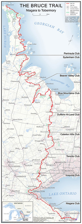
Getting on with the day, we continued our hike along the Laura Secord Legacy Trail. From this point, at the heart of Queenston Heights, it is an easy walk along wide paved pathways that wind through immaculate lawns, past General Brock's monument, the memorial to Tecumseh and the Queenston Heights pavilion to the trailhead at the west end of the park. Here the trail enters the Carolinian forest on the side of the escarpment and becomes a packed dirt footpath.


Throughout (as we have found in the past) we needed to watch the signage as there are a number of pathways in this stretch. For instance, the Trans Canada Trail itself frequently follows and diverges from other marked pathways including the Bruce Trail, the Laura Secord Legacy Trail, the General Brock Trail, and the Upper Canada Heritage Trails which weave throughout this region. Thankfully given the warm weather of the season, the pathway was dry and well packed making hiking easy in the well-shaded forest.
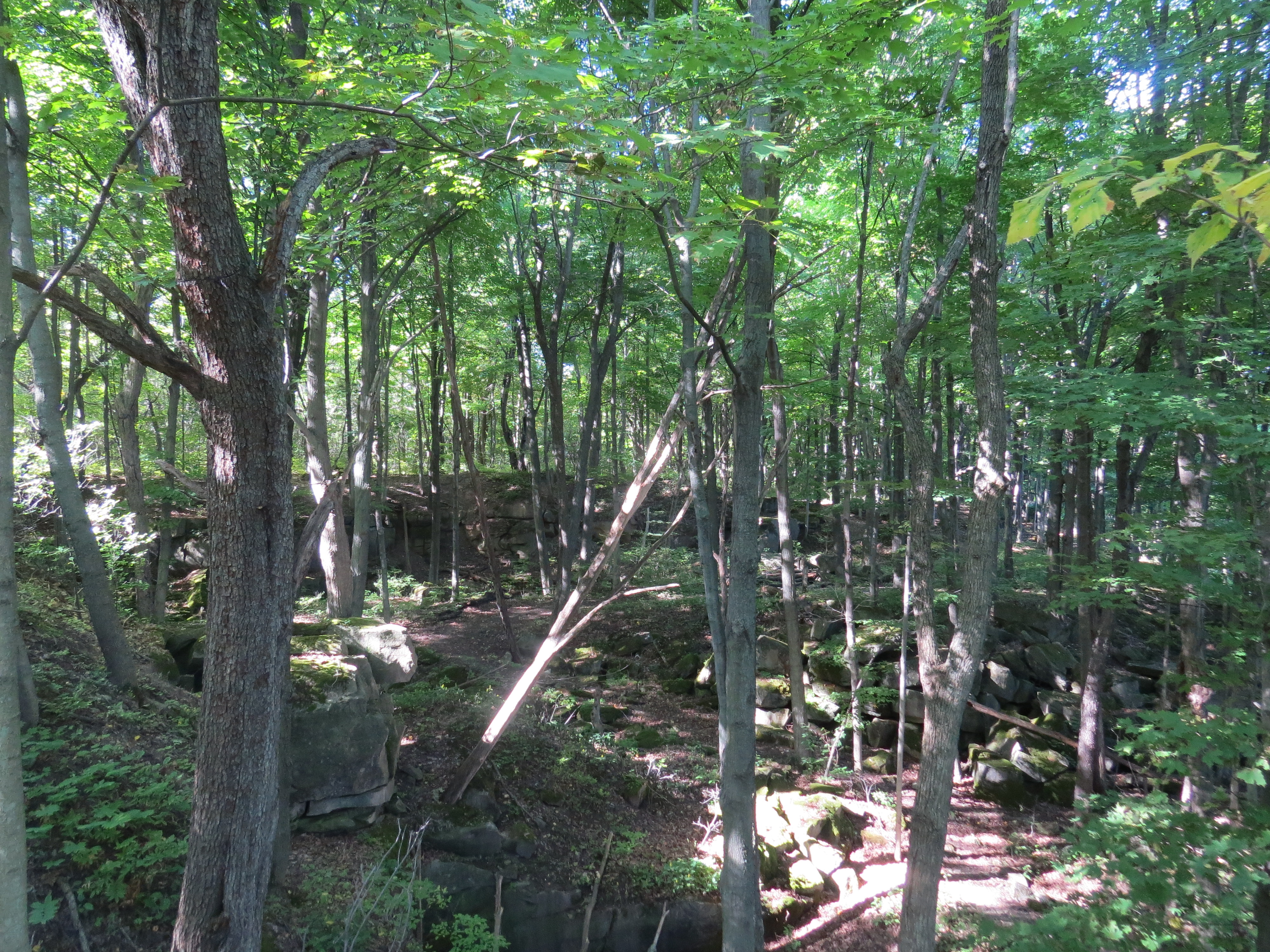


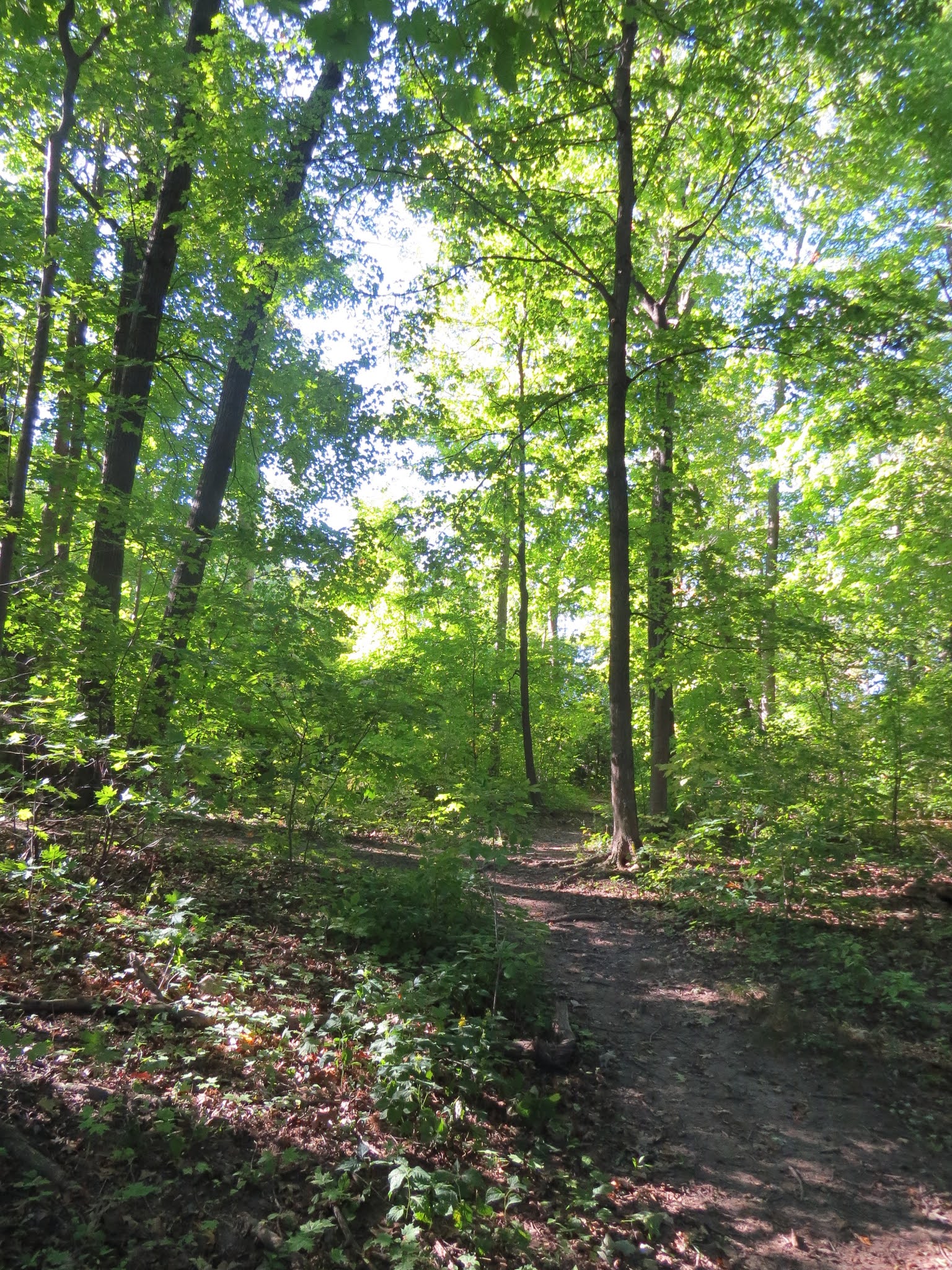
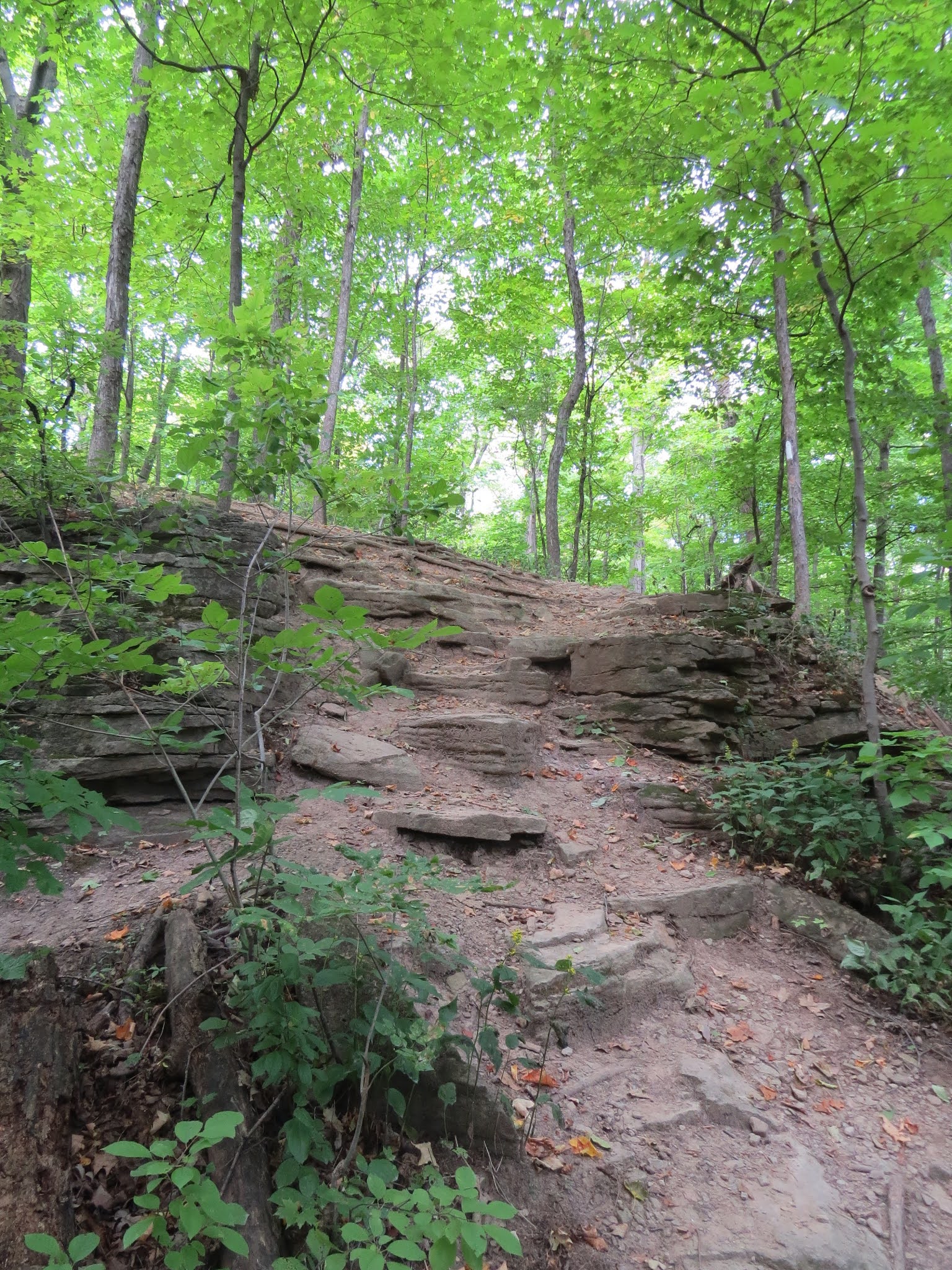
Within the first few minutes of hiking, we crossed a small but beautiful waterfall. Quite a lot of water was making its way down the escarpment at this point, which we thought a bit unusual for this time of year until we realized it was flowing out of a pipe a couple dozen meters above the trail. Although this section of the trail is relatively flat and wide, it sits about halfway up the escarpment. The exposed limestone of the escarpment is visible and provides many interesting configurations. A little farther along, the trail passes to the north of the Queenston Quarry, which can be seen through gaps in the trees. The first glimpses of the quarry show a deep, angular, well-defined pit with straight, exposed walls, whereas farther along the depression appears less well-defined and trees have begun to reclaim the operation. At the bottom of the escarpment, there appeared to be a marsh, where the sound of frequent shots could be heard, marking the presence of hunters in the region.


Venturing onward the flat dirt pathway traced the edge of the escarpment and wove through the forest which was a mixture of species indicative of the Great Lakes-St. Lawrence region as well as Carolinian. Throughout it all, the Virginia creeper and poison ivy climbing the tree trunks provided bright red accents, lending some impressive colour to the region.


From time to time, given how clear the day was, we could see the Toronto skyline and the CN tower in a break through the trees.

This was followed by glimpses of houses at the foot of the escarpment, and as we continued along we passed St. David's Golf Club, and the sounds of hunting were replaced with a single "fore!".

Eventually, the trail emerged onto a small drive alongside the Niagara Townline Rd, which was followed by a short walk along the edge of St. Paul Ave. This was quite a busy street, with rather narrow shoulders. Although it was obvious that we needed to turn left on reaching the road, the blazes did not clearly indicate which side of the road we should be on. As it turns out, it is safer to cross this road closer to where the trail emerges than farther along, because the spot where the trail re-enters the forest is on the opposite side of the road near the top of a hill, with limited visibility. Despite the relatively cool temperature of the morning, the roadway was oppressively warm. In any event, it was a short (500 m) walk along the road, which passed under Highway 405 before re-entering the forest.


We eventually emerged from Walker Park onto Dorchester Road. We crossed the road and the railway tracks and immediately rejoined the footpath, which continued parallel to the railway tracks. Fireman's Park consisted of another relatively flat patch of Carolinian forest, with few escarpment features in evidence. At the west end of the Fireman's Park, the trail emerged into an open area, resplendent with the sound of crickets and grasshoppers and the gorgeous purples, yellows, and whites of asters, goldenrod, and fleabane. Amid the welcome stretch of warmth and sunshine, the trail crossed Mewburn Rd.


This road reaches a dead end a few dozen meters north of the trail crossing, where the bridge over the train tracks has been closed off. The bridge may not be the safest structure in the world, but it provided an interesting view down a double set of tracks.


Crossing the QEW
On the other side of Mewburn, the trail continued along the tracks, with an open field and some drainage or sewage ponds on one side and a thin band of trees on the other. The sounds from the QEW, which have been audible for some time at this point, continue to grow in volume until the trail reaches a pedestrian bridge that spans across the highway. Tall wire mesh fencing extends up over the bridge, not quite meeting in the center. Beside the pedestrian bridge is an older, flat metal span for the train crossing.


On the other side of the QEW, the train continued along the train tracks for another couple meters, through an open area, until it turned sharply north to duck through the ‘screaming tunnel’. At the time of our crossing, we did not know the original purpose of the tunnel, or why it was called the 'screaming' tunnel. It is a tall, narrow tunnel with a rounded ceiling that is made of stone blocks. As it turns out this tunnel has been the site of local legend and is enmeshed in regional ghost stories. Apparently, this tunnel was not part of an old road or rail line as we had originally assumed but was instead a means of easily transporting water between fields under the rail line above. According to local legend, it is rumoured that a young girl was either burned to death or was killed and had her remains buried in the passage. Moreover, according to regional myth, if you light a match in the tunnel at midnight you can hear her screaming! Regardless of its history, the Screaming Tunnel is gorgeously constructed and peaceful to hike through.

Through the passage, our route took us on a brief hike along Warner roadway past vineyards, and farmland towards Woodend Conservation Area. In the fields around us were horses and cows luxuriating in their respective fields. Our route then abruptly turned down the side of someone’s property giving us access to Woodend Conservation Area. Yet another reminder of the important role which local landowners play in the development of our trail systems!

Woodend Conservation Area


Welland Canal
Trekking on we found ourselves navigating the side of the local roadway for some time before arriving at the Welland Canal and an impressive Vertical-Lift Bridge! Having trekked this region in the past we took a few moments while the bridge was closed in preparation for a ship to explore and revisit the historic and now unused canals.


One of the fascinating things throughout this region is the ability to see the historical remains of past undertakings. Here we are able to visit some of the original canal systems which have long since been left to nature to reclaim.

The Welland Canal was initially built in 1829 and subsequently rebuilt or renovated in 1845, 1887, and 1932. The surrounding town has also been alternatively known as Slab Town, the hamlet of Aqueduct and later Merrittsville until 1858 when it was renamed Welland by Gov. Simcoe after the Welland River in Lincolnshire England. The waterway system serves to allow ships to cross the Niagara Peninsula connecting Lake Erie to Lake Ontario as well as the St. Lawrence Seaway through a series of locks which move ships around Niagara Falls. The majority of the road and rail crossings in the Welland system are movable bridges, vertical lift bridges or tunnels. Since the early nineteenth century, the Welland Canal has allowed raw materials and cargo to be shipped from throughout the Great Lakes to the Atlantic Ocean giving way to Industrial growth in towns like Cleveland, Chicago, Detroit, Thunder Bay and Toronto.

During our hikes throughout this region, we have always relished the time spent watching the huge freighters moving through the locks. I have also been amazed (as I have at train crossings) to see the sheer number of people who come out simply to watch and photograph these ships! Today we watched a freighter move through while relaxing on the grass nearby under the shade of a tree.
With the ship through and bridge lowered back down we were able to trek across the canal and continue along on our way. Here we were presented with a challenge – whether to continue following the TCT path which signs indicated was closed and which the map showed as meandering along city streets and through residential neighbourhoods or to divert along the more scenic and shaded Bruce Trail?
Uncertain given the signage which suggested that the Trans Canada Trail was closed in St. Catharines we shifted onto the route we were more familiar with – the Bruce Trail.
With our decision made, we followed a local trail southbound alongside the Welland Canal until we again met back up with the BTC blazing.


Our chosen path next led us through a wonderful green space and at one point crossed over a rail line. For whatever reason we found it momentarily odd to find trail blazes and indicating arrows on the side of train rails rather than on trees, posts, or signs. Uncertain whether the track was still in use we did not doddle on the tracks for long, and were soon back into the forest on the other side.


St. Catharines
Navigating through the woods the trail soon traced in a narrow green corridor between two neighbourhoods. Unfortunately, over the years, a great deal of household rubbish and trash has been tossed behind many of these houses littering the beauty of this stretch of the trail. The sound of cars on the nearby roadway, lawnmowers in yards, radios on porches, and the sheer number of people hiking reminded us that we were now in town and no longer in the wilds or forest.
Crossing over Merritt St. the trail soon took us into and through Mountain Locks Park to the Merritt Trailhead. Here we again briefly followed along sections of historic water canals prior to joining with the Meritt Trail which took us to one of the region’s largest shopping malls – the Pen Centre.


Comments
Post a Comment