Stealth Camping the Bruce Trail : Metcalf Rock to Eugenia
Stealth Camping the Bruce Trail
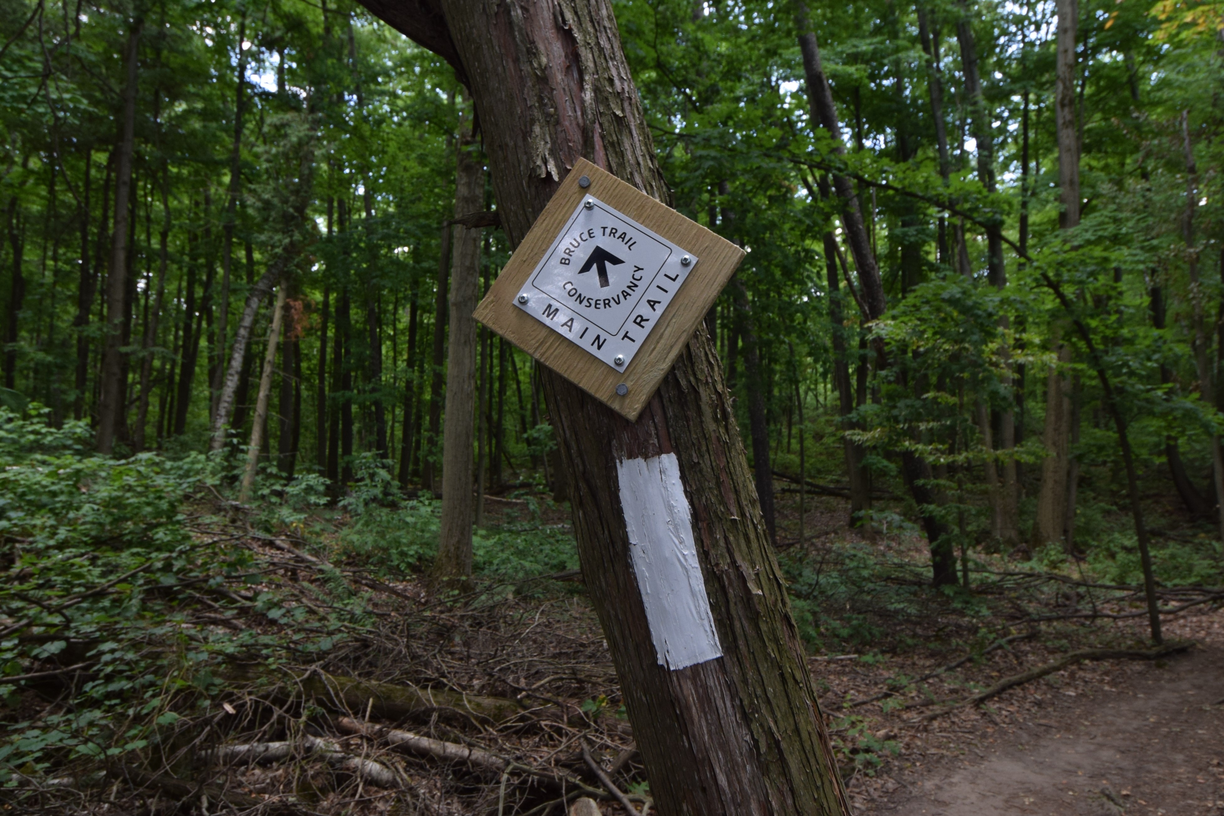
Beaver Valley Section
The alarm on my cell phone went off at 5 AM this morning. I knew that we had to get up and have our campsite packed and cleaned before anyone would likely be on the trails. So, with stiff bodies that felt as though they had just lain down, we began the process of packing in preparation for our second day in the Beaver Valley section of the Bruce Trail.

Until recently, we have been hiking between parked vehicles. However, in the Beaver Valley section, this is no longer possible, and so now, without the option to drive off the trail to get to lodging, we have to stealth camp. The Bruce Trail, for a number of reasons, has never really developed camping or a thru-hiking culture along the route. Yet to anyone who has trekked the Bruce Trail, it is not uncommon to find campers and campsites along the way – as practically speaking wild camping is the only realistic means to thru-trek the Bruce End-to-End in a single hike.
Leave No Trace
With our sleeping bags, thermarests, and tent packed we boiled water, made coffee, and had a breakfast of wraps with jam and peanut butter. This was a simple breakfast that was easily prepared and created a little mess. With our morning meal completed and the last of our gear packed, we went back over to our campsite to ensure that we were leaving no trace of our evening in the region.

On both the East Coast Trail and Trans Canada Trail, over hundreds of days of wild camping in recent years, we always practice Leave No Trace Principles in nature. We follow the simple rule of leaving nothing behind in order to protect the environment, allow others to enjoy nature, and foster responsible outdoor recreation. The easy-to-follow Leave No Trace Principles include:
(1) Plan Ahead and Prepare which means that we should all use gear and food that leaves no waste behind and creates a limited environmental footprint.
(2) Camp on and hike on durable surfaces to limit the impact of our activities in nature.
(3) Pack it in, Pack it Out, or put another way, what we bring into nature should also be carried out and disposed of properly.
(4) Dispose of waste properly. Limit the use of soap and the amount of food waste put into nature and avoid contaminating water sources. Dispose of human waste responsibly.
(5) Leave what you find follows the old adage of taking only pictures and leave only footprints in order to preserve the natural heritage of an area. To do this properly, do not damage live trees and plants, leave natural objects and cultural artifacts as you find them, and do not alter the area.
(6) Minimize campfire impact. Minimize the use of and impact of fire. This is the main reason we carry a stove and fuel and eat cold food - so that we never have to build a campfire, worry about completely extinguishing it, or work to obliterate the traces it leaves upon departure.
(7) Respect wildlife. Do not disrupt habitat, upset burrows or nests, properly package food so as not to attract animals, and do not feed wildlife.
(8) Be considerate of others. While exploring, act with courtesy towards others, allowing them to enjoy pristine wilderness and connect with nature.

In short – leave the trail in the same condition or cleaner than you found it. The goal is to preserve the integrity, stability, and beauty of the natural environment during a time when the rising number of people heading into the outdoors has led to regions being “loved to death” by recreationists. What is increasingly needed is to foster an abiding appreciation for wild places, wildlife, and nature to ensure that all people have the opportunity to enjoy a pristine nature experience.
Assured that we had minimized our footprint and packed out everything we brought in, we navigated back through the network of ski trails to the main route of the Bruce Trail. Once back on track, we re-trekked through part of the Kolapore Uplands and again climbed back to the top of the Metcalfe Rock summit before descending off the escarpment.
Duncan Crevice Caves Provincial Nature Reserve
With the Kolapore Uplands now behind us, we crossed the 110th line concession and hiked the perimeter of farmer’s fields. Looping across the landscape, we were soon following along the base of the escarpment, before switch backing up to the top again. All in all, it was a rugged climb with our backpacks on, ascending up into Duncan Crevice Caves and Provincial Nature Reserve.

After spending so long on the Niagara Escarpment, it was stunning to realize that it is not a singular geological feature. Instead, after trekking part of the Beaver Valley section, we have come to see that in places the escarpment is broken, having been separated by erosion and the challenges of time. As a result, in some areas, the Bruce Trail weaves up and down through stunning fissures in the rock formations. Throughout this stretch, we repeatedly came upon huge cracks in the escarpment, giving us both amazing and terrifying views of the surrounding agricultural landscape and drop-off.

Of particular note was the dolostone piece of the escarpment known as Pinnacle Rock. Upon arriving at this geological wonder, we found a gold and green plaque on the rock noting that the property we were currently trekking through was recently donated to the BTC. It was previously known as Pinnacle Rock F=arm and has been left in trust to the Bruce Trail in the hope that the wetlands, waterfall, Pinnacle Rock, and wildlife throughout the region will be protected and preserved.
Following our time in the forests of the Duncan Crevice Caves Nature Reserve, the Bruce Trail again wove us out onto roadways and concessions.
The Concessions of Duncan
Following country lanes, we navigated past the crossroads of the hamlet of Duncan, past the historical yellow brick Union Church, and past historical wooden barns with their ironic red roofs. These quiet concessions lasted for only 3 kilometres, taking us down Fox Ridge Rd before arriving at a BTC parking area. Having covered some 10 kilometres since setting out this morning, we took a break and enjoyed a treat of Cliff Bars while resting without our backpacks and hiking shoes on. With no need to rush, we enjoyed our half an hour there at the base of the hillside before packing up our wrappers, tightening our water bottle lids, and setting out again.
Climb to McCluskey’s Rock
Continuing to follow the road allowance of Fox Ridge, from the parking lot we trekked along the side of the escarpment before descending back downhill along a slippery and tough section of rocky scree. Frustratingly, this was followed by what turned out to be a very tough climb amid the rocks through a gap to the top of the escarpment. Exhausted by the ascent, we quickly unstrapped our backpacks and sat for another quick break in a well-forested and well-shaded spot. Back on flat ground, we found a wooden sign for the Bruce Trail pointing both south and north. Noting that Queenston was some 455 km to the south and that Tobermory was “a mere” 415 km to the north! Back on the top of the escarpment, following the muddy footpath, we wove around McCluskey's Rock and promptly began our descent toward Old Baldy Conservation Area.
.jpg)
While much of this stretch seemed arduous and filled with relatively pointless ups and downs, the benefit was that it gave us opportunities to watch kettles of Red Tailed Hawks and other Buteo as well as of Turkey Vultures who were playing amid the valley’s updrafts. While enjoying the site of so many birds soaring above us, we took in the peacefulness of the region.
Signs of Progress
.jpg)
Passing the Ken Young Side Trail, we soon arrived at Sideroad 7B, which we were supposed to cross. Unfortunately, upon our arrival, we discovered that the BTC had been rerouted, with the detour taking us along roadways rather than Trailways. As such, instead of heading into Old Baldy Conservation Area, we had to trek on the side of the road to HWY 13, which we then followed south through the town of Kimberly and onto the Artemesia-Eurphrasia Townline, where we could rejoin the BTC. This detour involved a distance of 5.5 km of extra roadway. From what we can discover, a local landowner has recently purchased property here and permission for hikers has been removed.
Reroute to the Town of Kimberley
Forty minutes later, we walked into the town of Kimberley, Ontario, a community named for the 1st Earl of Kimberley, who was a British politician involved in the administration of Canada’s colonies. There a number of historical wooden buildings have been terrifically preserved, including a Victorian mill and a period General Store.
.jpg)
Beyond the historical delights of the town of Kimberley, we benefited from the reroute by being able to stop for a coffee and sandwich at a local establishment before pushing on along the uninspiring Beaver Valley Rd.
Rejoining the Bruce Trail
A few minutes outside of town we found re-route signs for the BTC pointing us down a gravel track by the name of Sideroad 4B, which led us to undertake a steep climb back up the escarpment. This reroute soon had us trekking along fence lines and an old stone wall along the access road to the southern edge of the Old Baldy region and back to the main Bruce Trail route. Unfortunately, after this climb, we turned onto the 4th Line A concession, which we followed for only ten or fifteen minutes before turning once again onto the Artemesia-Euphrasia Townline, which took us back to the roadway only slightly south of Kimberly. As a result, we felt as though the last hour’s walk from Kimberley had been for nothing.
This feeling of frustration was only amplified by the fact that we were now looking at a sign for the Valley Crossover Side Trail – a route spanning the two sides of Beaver Valley, which would have cut 30 kilometres off the Bruce Trail if we had chosen to take it. Indeed, until 2008 the side trail that lay in front of us was the main route of the Bruce Trail. Had we not already had reservations in Eugenia for tonight, I think our resolve to walk the entire Bruce Trail would have crumbled right there. Instead, we begrudgingly turned and continued our walk amid the heat of day towards Campbell’s Hill and Eugenia Falls Conservation Area, still some 10 kilometres to the south of us.
Continuing on, the trail navigated through fenced boundaries and soon plunged back to the ridge line of the forested escarpment, weaving up and down the steep topography past creeks and a waterfall. The highlight of this section was that at one point we could see the towers of the Eugenia Hydro facility, as well as water towers, pipelines, and hydro lines, which spanned the valley. This facility has apparently been in operation since 1915 and is used to pump water from Lake Eugenia. The industrialized footprint of this facility served as a reminder of the immense ways that we have transformed the landscapes of the nation, even amid so many protected spaces and conservation areas.

Soon after, we were back on the top of the escarpment again – and took our third break for the day. Navigating the rocky terrain was quickly doing our legs in and draining us of energy. Thankful for the chance to take off our shoes and rest, we then pushed on, only to discover that depressingly the trail wove downhill, only to just as quickly turn and re-ascend the escarpment. In short order, we then crossed a roadway, passed another side trail, and arrived at Campbell’s Hill.
Leaving the forest behind, we now stood on the northern edge of the community of Eugenia, and thoroughly exhausted, we were sorely tempted to simply walk into town and be done for the day. But once again, stubbornness and the promise to walk the full length of the Bruce Trail pushed us to our destination, now only 2 kilometres away along the path.
Eugenia Falls Conservation Area
Pushing on, we followed the road allowance of North St back into a dense forest. On the way, we passed a stunning stone arch with no signs indicating its purpose or origins, before climbing to Eugenia Falls at the heart of Eugenia Falls Conservation Area.

As we traversed our final park for the day, we met an unassuming day hiker who asked us about our own trek. We told him about our many day hikes and End-to-End undertakings, as well as our hope of walking all the way from Niagara to Tobermory. Amid our description, he stopped us and suddenly proclaimed that unless we did the Bruce Trail on a single thru-hike, we should NOT consider ourselves real hikers or to have actually hiked it. According to him, only thru-hikes count. We were promptly told to give up and go home. Startlingly, he did not wait for a reply, but simply turned and walked away, leaving us stunned by his judgmental comments. Having spent so much time trekking north, and now having risked stealth camping on the Bruce for the first time ever. We came out concerned about what people might say to us – but this random encounter was never one we expected.
There is no denying that there comes a point in every excursion when you begin to question the plan and theory – whether from exhaustion or the realities being presented to you. Questions immediately arise, like what makes a true hiker? Do you have to have personally walked and traversed the entire distance? What about side trails? Do you have to walk them in order to walk the entire trail? What about using shelters and hotels en route? Do you have to have cooked all of your own food or is visiting restaurants ok? Our own solace eventually came in, remembering the words of Pat from the Bruce Trail Main office, that “everyone walks their own trail”. This simple yet profound truth carried us through many a day’s consideration of whether to cut out part of the trail system, take a shortcut or give up altogether. In our opinion, it is not the physical demands but the mental challenges that are the hardest obstacles to overcome on any trail.
Town of Eugenia Ontario
Arriving at the Eugenia Soldiers War Memorial and Bruce Trail parking lot, we reached our destination – the town of Eugenia. Tired and a little depressed by our recent encounter with a fellow hiker, we descended into town. Hungry, and regardless of our sweaty appearance and backpacks, we stopped first at the Flying Chestnut Kitchen to enjoy a fresh salad, a massive bowl of vegetables and pasta in addition to a couple of pints of well-deserved cold beer. Afterwards, ready for sleep, we checked into our accommodations, cleaned up, showered, and were fortunate to be able to launder our clothes!

While not an overly tough day of hiking, the combination of the reroutes, constant ascents and descents, as well as the heat of the day, took its toll on us. And so, with daylight still blazing outside, we nonetheless collapsed into bed with our bodies sore from being out of shape after a winter spent at desks. With 26 more kilometres of the Bruce Trail completed, we decided to “fix a logistical problem” and make tomorrow’s trek a loop back to Eugenia without our backpacks!
See you on the Trail!
Comments
Post a Comment